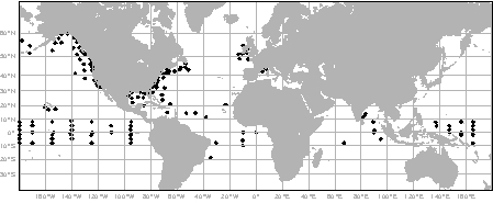
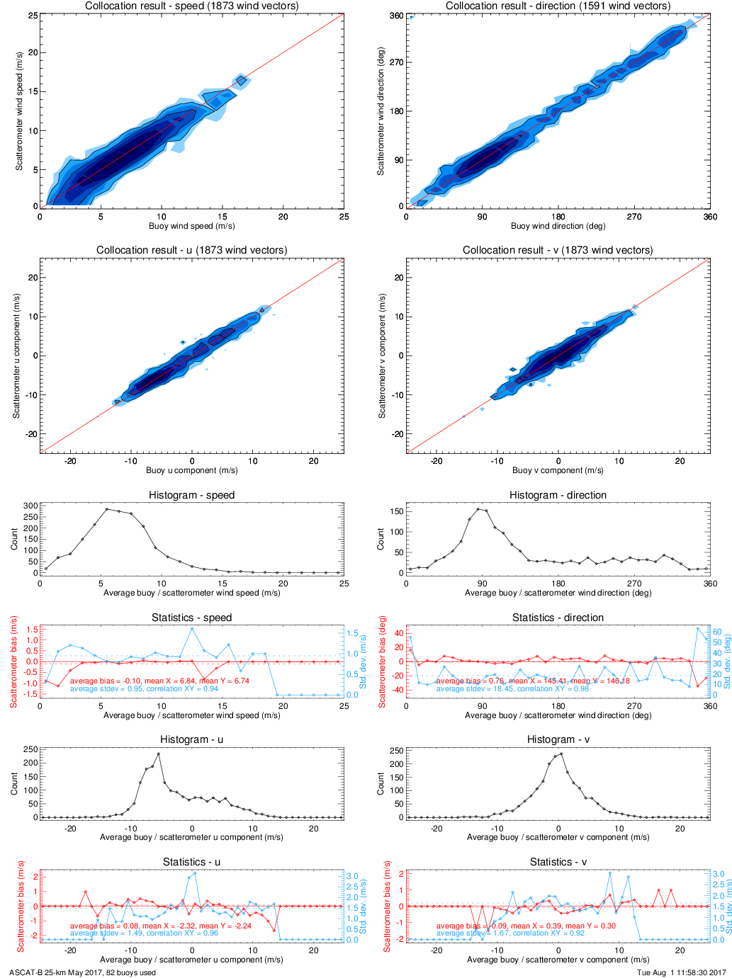
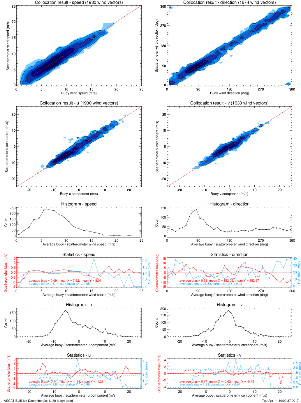
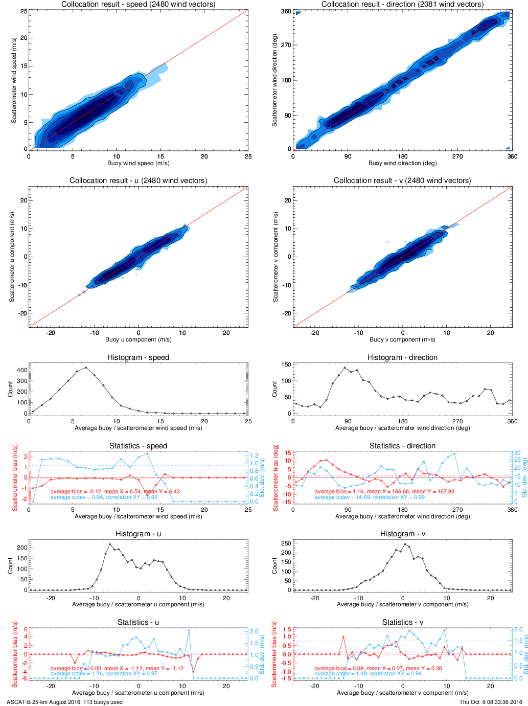
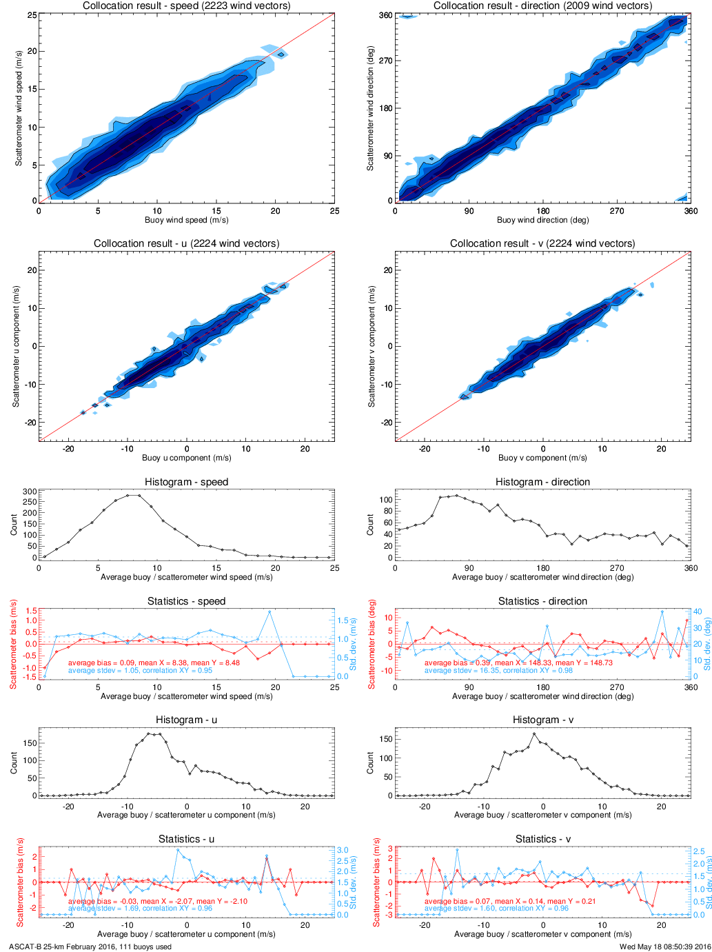
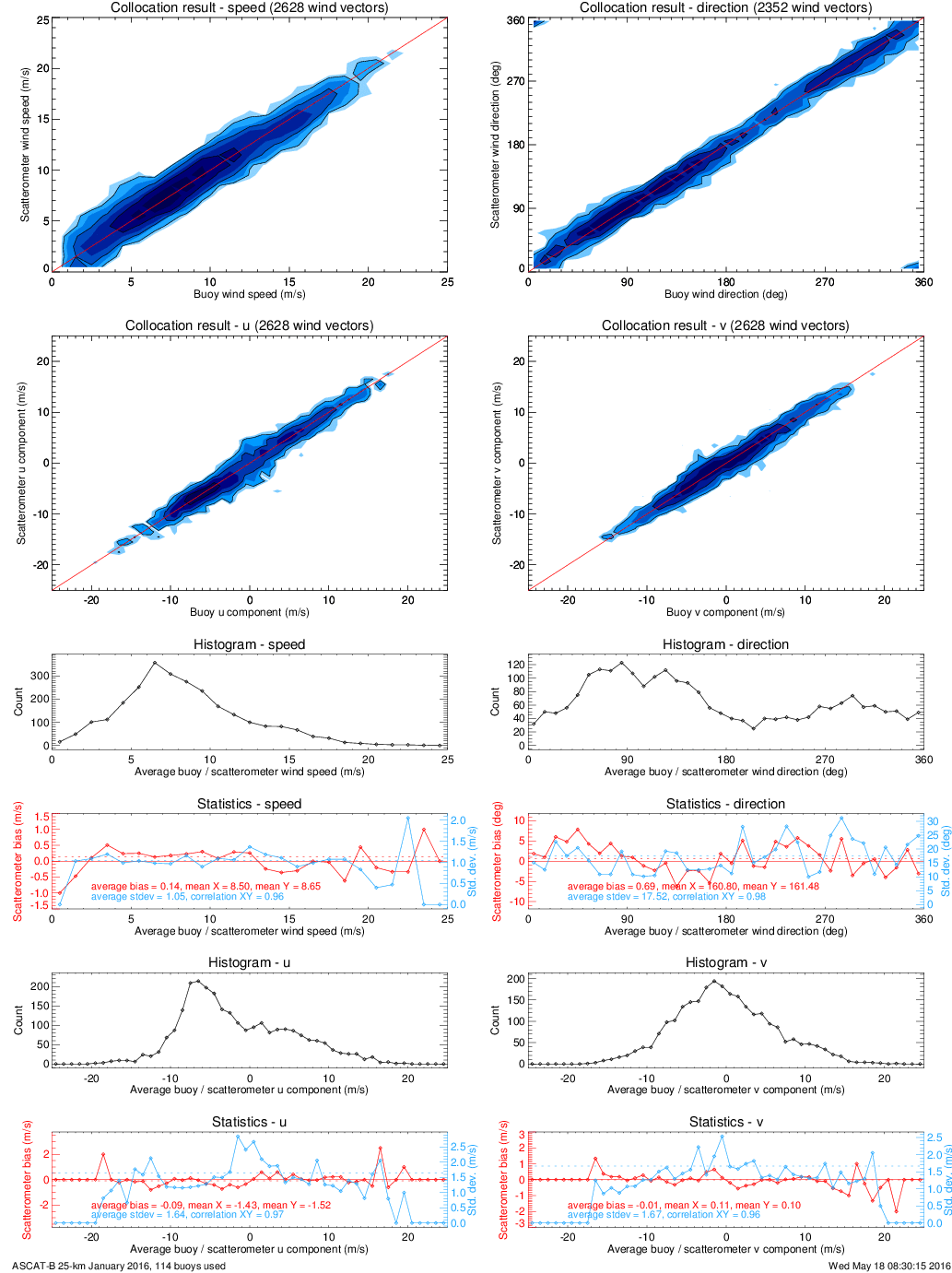
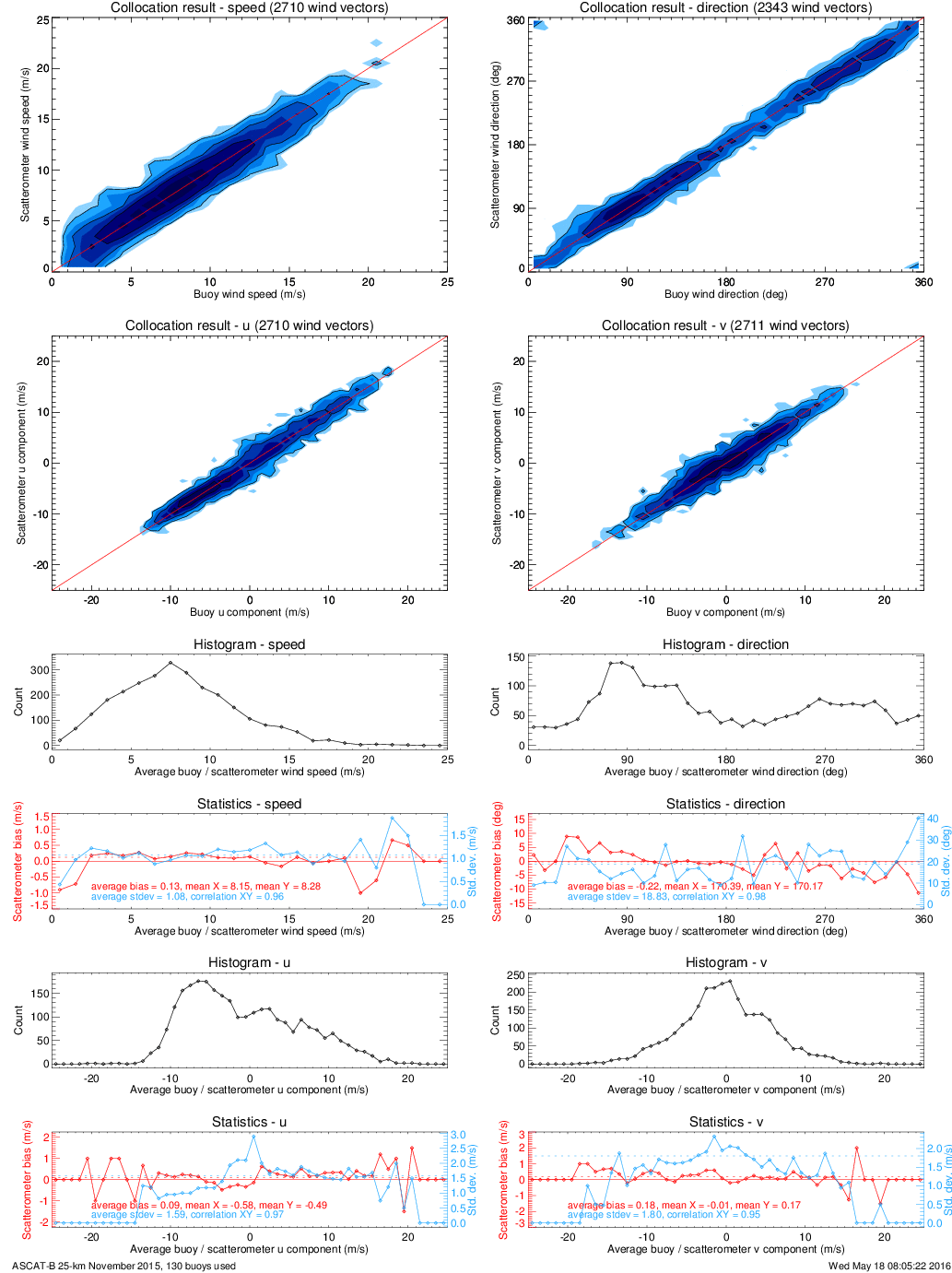
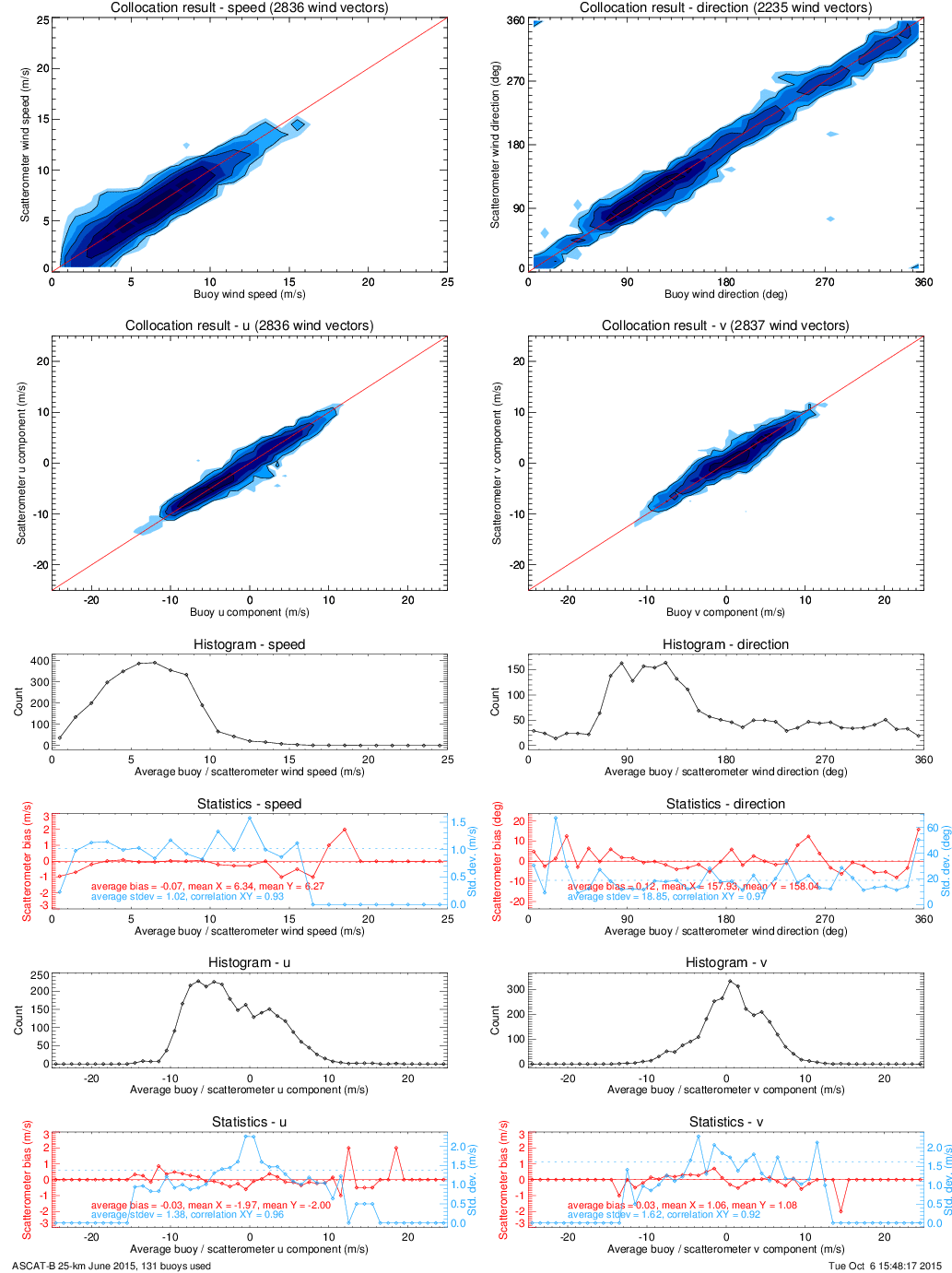
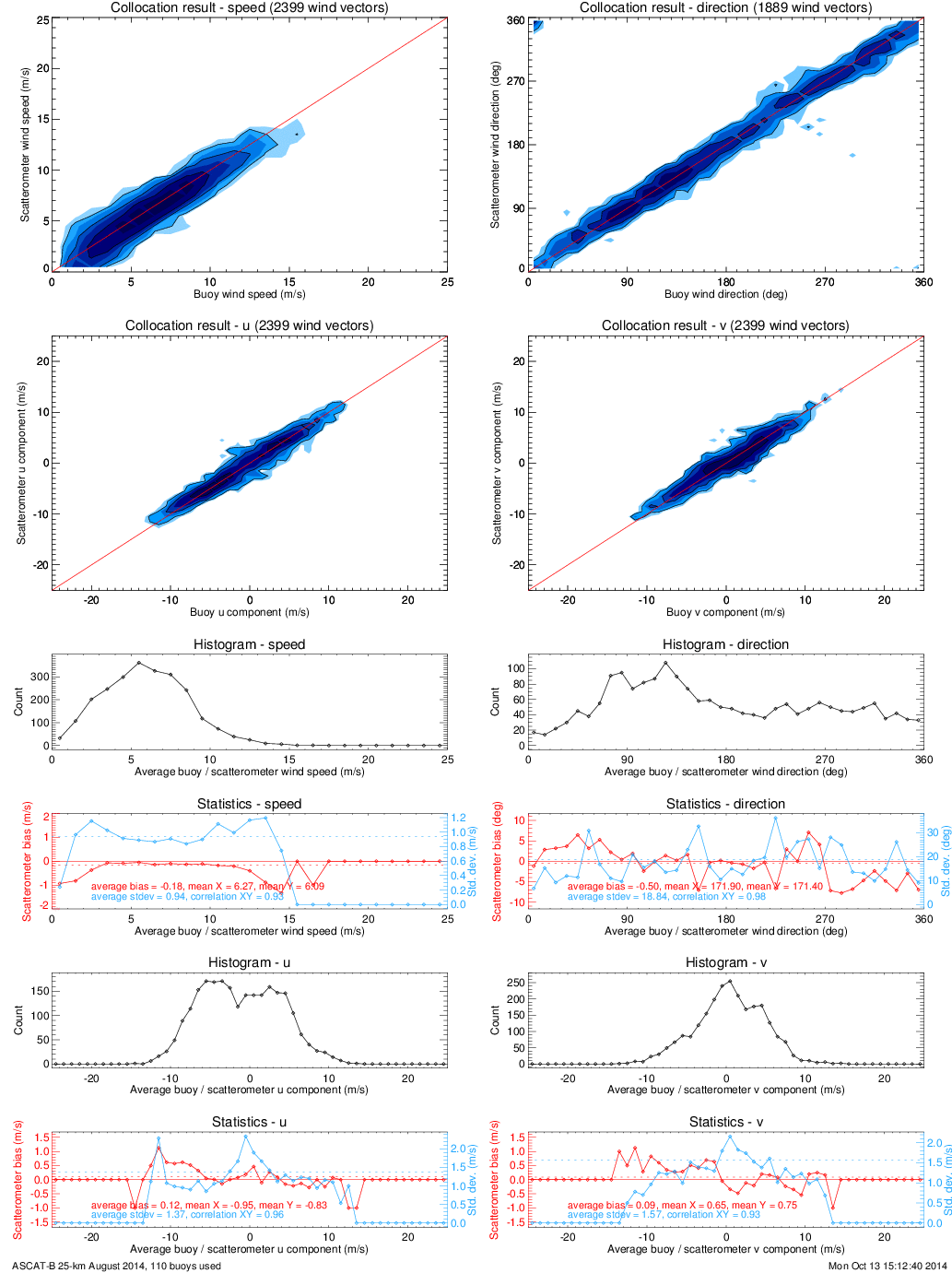
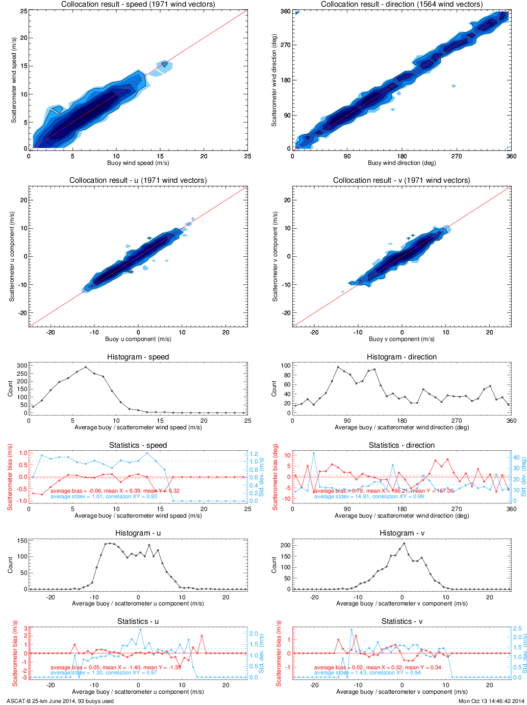
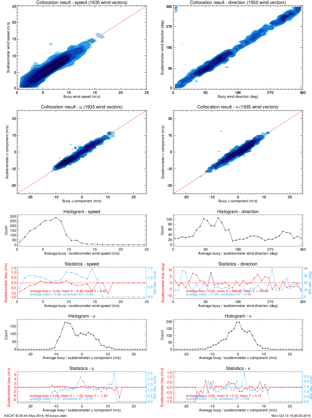
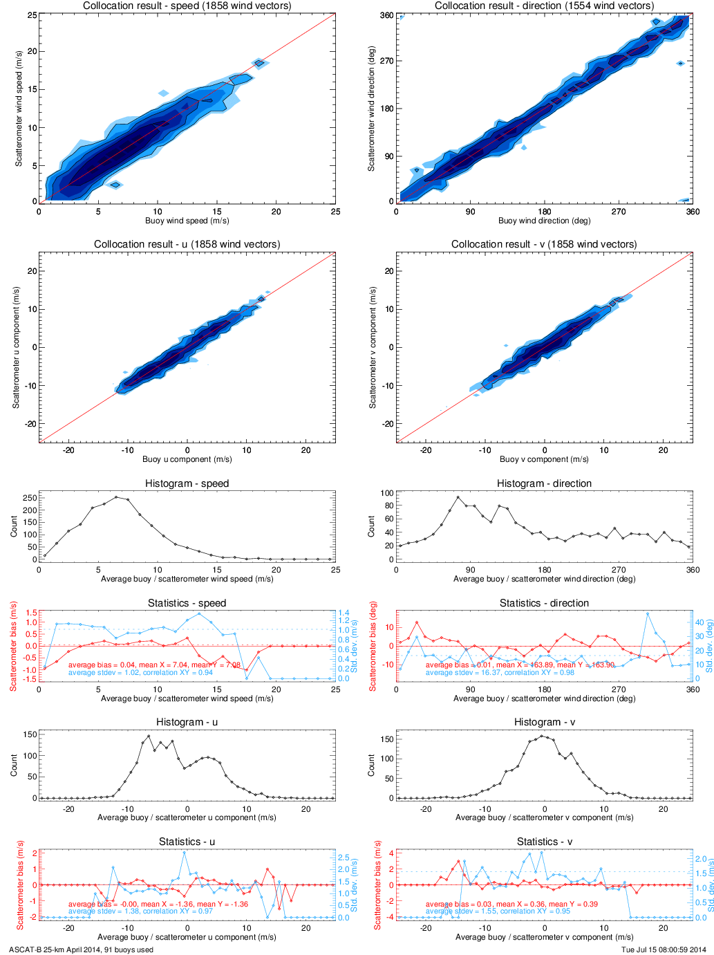
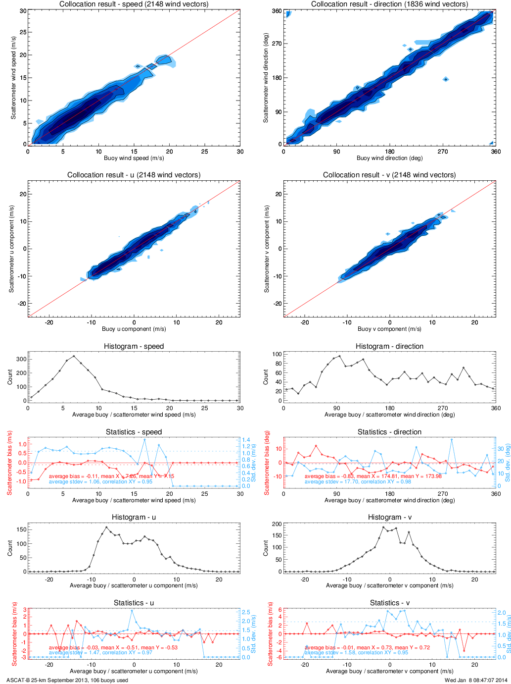
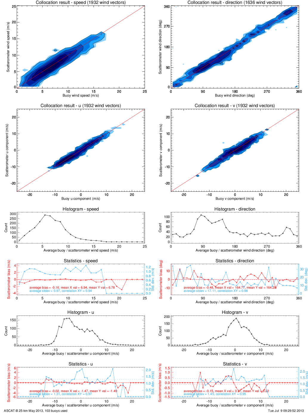
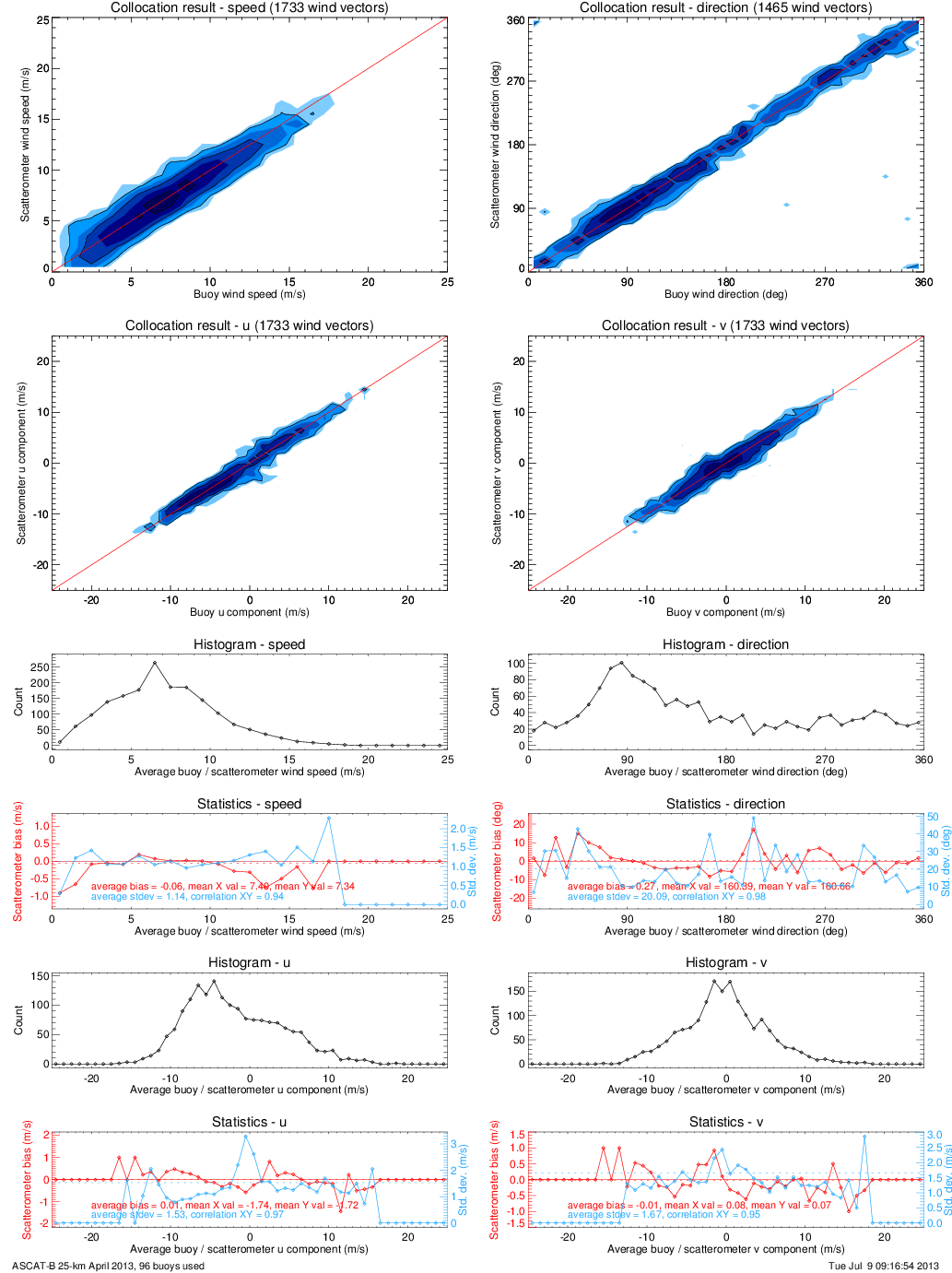
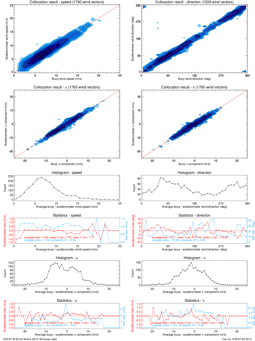
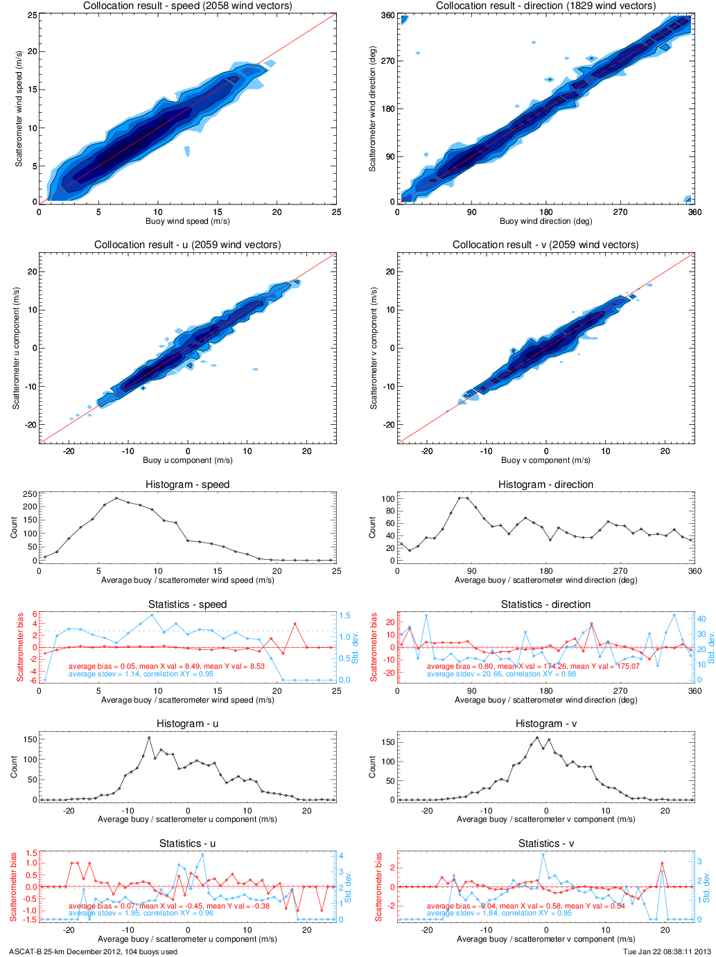
This page provides collocations of the scatterometer wind data and buoy winds. The buoy winds are distributed through the GTS and have been retrieved from the ECMWF MARS archive. The data of approximately 140 moored buoys spread over the oceans (most of them in the tropical oceans and near Europe and North America) are used. See below for a plot of the locations of the used buoys.
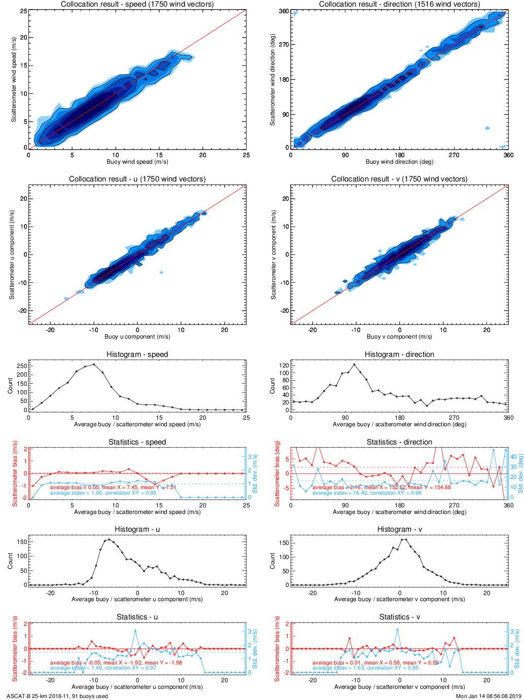
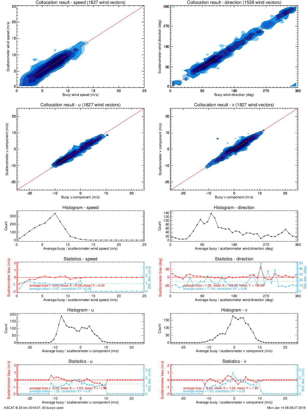
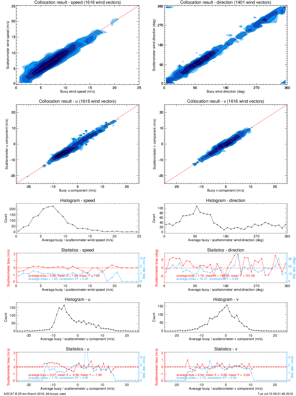
Each link on the right hand side under 'Buoy collocations' will show a plot of the collocations of one month. A scatterometer wind and a buoy wind measurement are considered to be collocated if the distance between the Wind Vector Cell (WVC) centre and the buoy location is less than the WVC spacing divided by sqrt(2) and the acquisition time difference is less than 30 minutes.
The buoy winds are measured hourly by averaging the wind speed over 10 minutes. The real winds at a given anemometer height have been converted to 10-m neutral winds using the LKB model in order to make a good comparison with the 10-m scatterometer winds possible. The plots show contoured histograms of the buoy winds versus the scatterometer winds (speed, direction, u and v components). The wind directions are computed only for buoy wind speeds of 4 m/s and higher. The contour colours and lines are in logarithmic scale: each colour change corresponds to a factor of 2, each contour line to a factor of 4.
References
Stoffelen, A., Scatterometry, Thesis: Universiteit Utrecht, 1998.
Portabella, M. and A. Stoffelen, Development of a global scatterometer validation and monitoring, OSI SAF report SAF/OSI/CDOP/KNMI/SCI/RP/141, 2007.
Portabella, M. and A. Stoffelen, On Scatterometer ocean stress, J. Atm. Oceanic Technol., 2009, 26, 368-382.
Acknowledgements
KNMI hosts the operational deployment of this scatterometer wind product as part of the EUMETSAT Ocean and Sea Ice Satellite Application Facility (OSI SAF), see related link or click on the OSI SAF logo above for more information.
The processing software for the wind products is developed in the EUMETSAT Numerical Weather Prediction Satellite Application Facility (NWP SAF) and OSI SAF.
We are grateful to Jean Bidlot of ECMWF for helping us with the buoy data retrieval and quality control.


